
Exploring the Great Outdoors: Unleashing the Power of Outdoor Apps
/In today's fast-paced world, technology has become an integral part of our daily lives, even when we venture into the great outdoors. Whether you're an avid hiker, a camping enthusiast, or someone who simply enjoys spending time in nature, there's a plethora of outdoor apps available to enhance and enrich your outdoor experience. In this blog post, we'll explore 10 of our favourite outdoor apps that cater to different activities, helping you make the most out of your adventures.
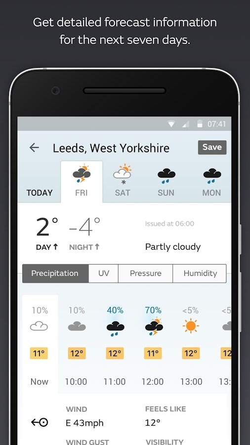
Met office
The Met Office, being the UK's national weather service, is generally considered reputable for weather forecasting. With detailed weather reports for your chosen area that detail chance of rain, temperature, pressure, humidity and wind direction, it’s certainly the number one app to check whenever you leave the house whether its a low level walk or venturing onto higher ground. Either way, you should always check the weather, as you can then decide what extras, if any, you’ll need in your rucksack. Inclement weather could well affect your choice of route, with swollen rivers and avoiding knife edge ridges in high winds.
Mountain Forecast Viewer
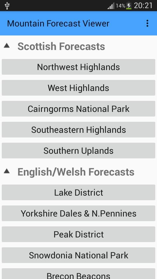
The official app of the Mountain Weather Information Service (MWIS), that provides a detailed daily forecast for all the mountainous areas of the UK. The Mountain Forecast Viewer App stands out as a valuable tool for individuals engaging in mountain-related activities. Its accurate forecasts, elevation-specific information, and user-friendly interface make it an indispensable companion for those venturing into the challenging terrains of mountains. The app not only enhances the outdoor experience but, more importantly, contributes to the safety and well-being of users by providing crucial weather insights.
Be Avalanche Aware
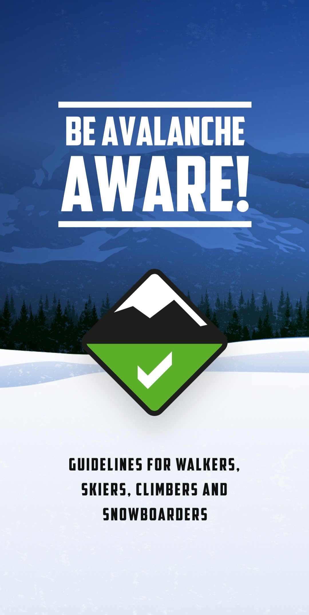
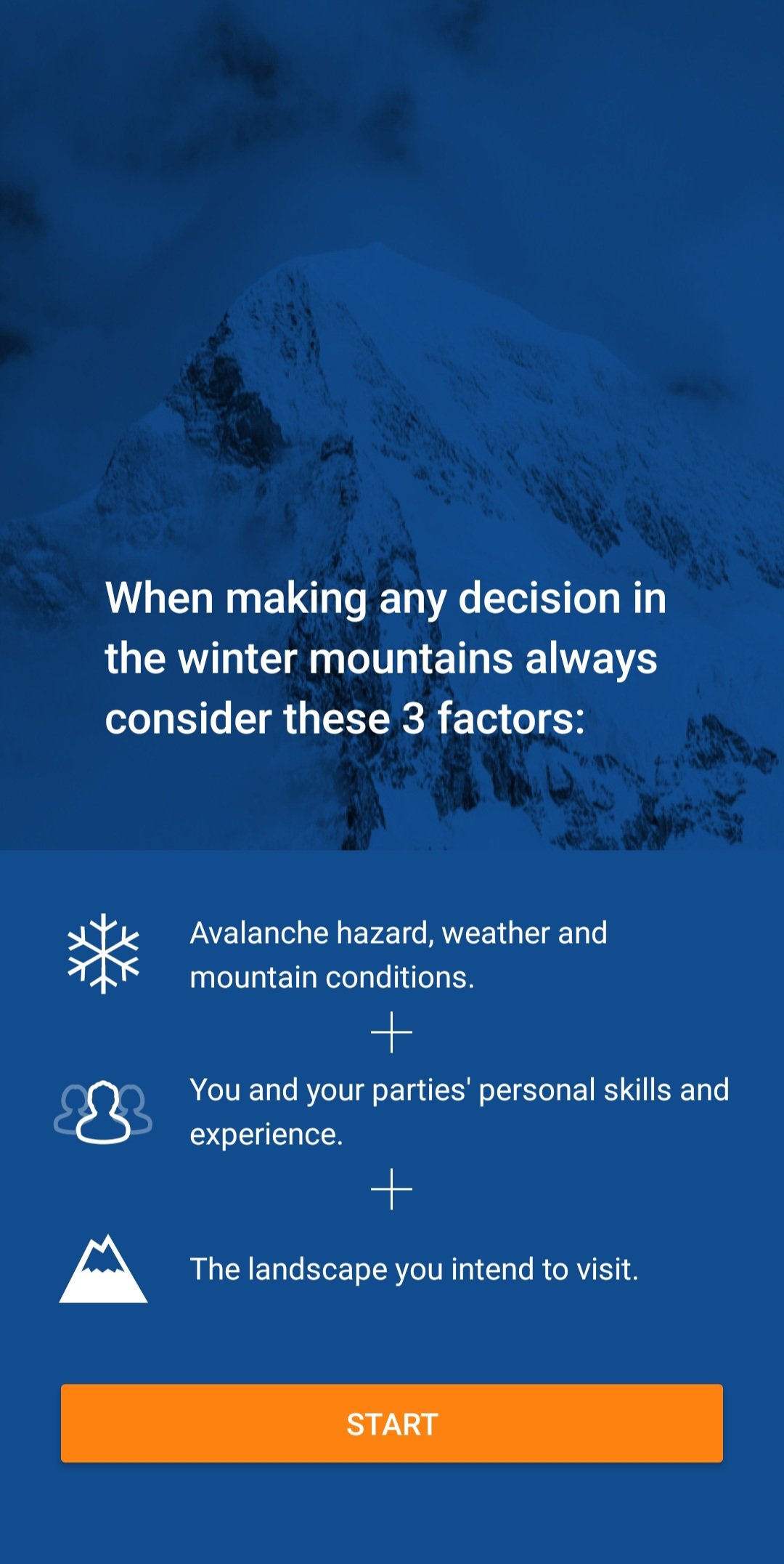
The official app of the Scottish Avalanche Information Service (SAIS), a must have app for anyone heading into the Scottish Mountains in winter. The "Be Avalanche Aware" app serves as a vital resource for individuals engaging in winter sports and activities in avalanche-prone areas of the UK. Its combination of educational content, real-time alerts, and trip planning tools makes it a comprehensive and valuable companion for those navigating the inherent risks of snowy terrains. The app not only enhances the safety of users but also contributes to the overall culture of avalanche awareness and preparedness.
OS Maps

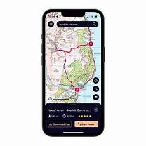
So now we’ve checked the weather on the above 3 apps, we can now start having a look at our route, and the app of choice has to be OS Maps (Ordnance Survey). Whether I'm hiking, cycling, or exploring new trails, this app has been a game-changer. An annual subscription to OS maps allows me full access to all maps of the UK, both in the 1:50K and 1:25K scales. I can download maps for offline use, perfect for those off-the-grid adventures and no more worrying about connectivity in remote areas. The basic subscription costs roughly £25 a year which can be considerably cheaper than buying several maps. Last year on The Great Outdoors Challenge walk across Scotland, I would have had to buy several paper maps, so having the app, printing my own maps and laminating them was a considerably cheaper option. The ability to plan routes is brilliant, your proposed route can snap to paths, give you the distance of the route, give you an elevation view and even a birds eye flyover view. If you are a regular walker then an OS subscription is a must. If you do buy a paper map, there is a scratch code inside the cover that you can put into the free OS map app. This code will then allow you to download the digital version of that paper map onto your OS map app free for 12 months. Even if you don’t buy any maps, the OS map app is still worth downloading, as you can get free access to the legends for both the 1:50K and 1:25K maps. Please note, that if you are printing maps from OS for commercial gain then you will need an additional licence at an additional cost. We highly recommend that you use a map and compass to navigate as navigating using a phone app will dramatically reduce the battery charge. Use occasionally to check where you are but remember to turn the app off when not in use. Just remember, that in an emergency situation a fully charged phone will be your best friend.
What3words

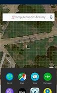
Love it or hate it, its another free app that’s here to stay, so rather than avoid it, we need to embrace it. A great app for meeting friends and family around urban locations or car parks at the start of a walk, but not ideal for when out and about on the mountains. It’s not a system favoured by Mountain Rescue Teams as there are too many possibilities of inputting an incorrect location due to a simple spelling mistake, adding a S onto a word, or putting a dot in the wrong place. W3W to their credit, have now added a 10 figure grid reference which can be added via the settings menu. While the app does offer offline functionality, it may have limitations in extremely remote areas or areas without any prior mapping data. Offline functionality depends on pre-downloaded maps.
Plantnet

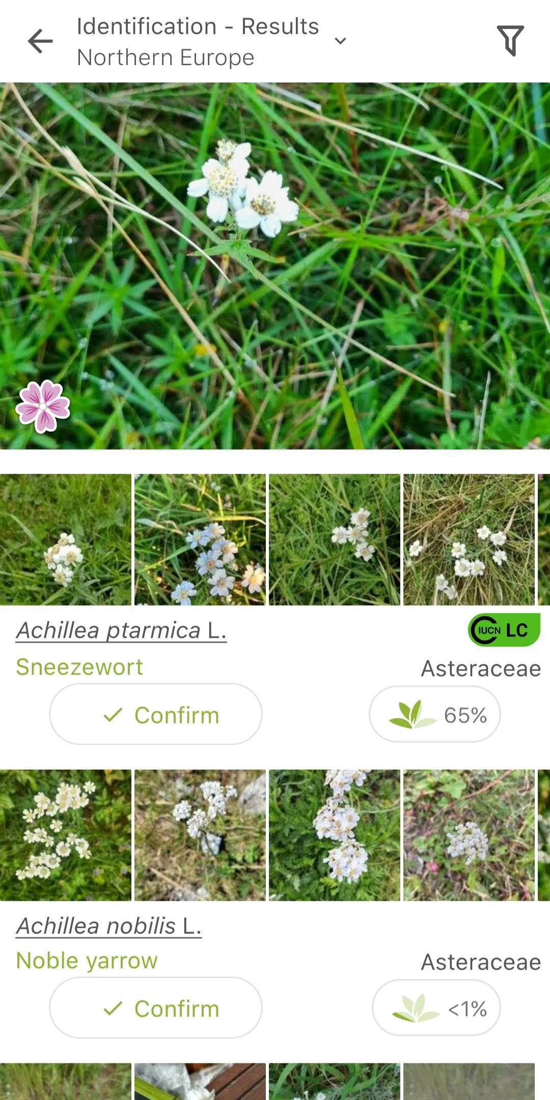
A brilliant free app that can help you identify most of the plants and trees in the UK. The app doesn't just stop at identification - it also provides detailed information about each plant, making it a fantastic learning tool. Simply take a picture and the app will tell you from the flower, leaf, fruit or bark what plant or tree you are looking at. Be mindful though that it gives you a percentage and it isn’t always 100% accurate. This app is a game-changer for anyone who loves plants, whether you're a seasoned botanist or just getting into the green world. It's like having a personal botanist in your pocket!
Merlin
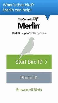
Another great free must have app for anyone that spends a lot of time in the outdoors. The app can analyse any bird song and tell you what bird you are listening to. Again not always 100% accurate in the Sound ID mode, but generally it does the job fairly well. Whether you're a birdwatching enthusiast or just curious about the feathered friends around you, Merlin's bird identification feature is truly spellbinding! Snap a photo, and let Merlin work its avian magic to reveal the bird's identity.
StarTracker


Ready to elevate your stargazing experience? Download StarTracker and get ready to be mesmerized by the wonders of the night sky! Simply point your phone to the night sky, and let StarTracker's augmented reality guide you through constellations, planets, and stars. It's like having a personal planetarium right in your pocket! Perfect for anyone that enjoys being out at night, perfect for them wild camps and night walks. You’ll probably want to turn the background music off, as it can get a bit annoying after a while.
PhotoPills

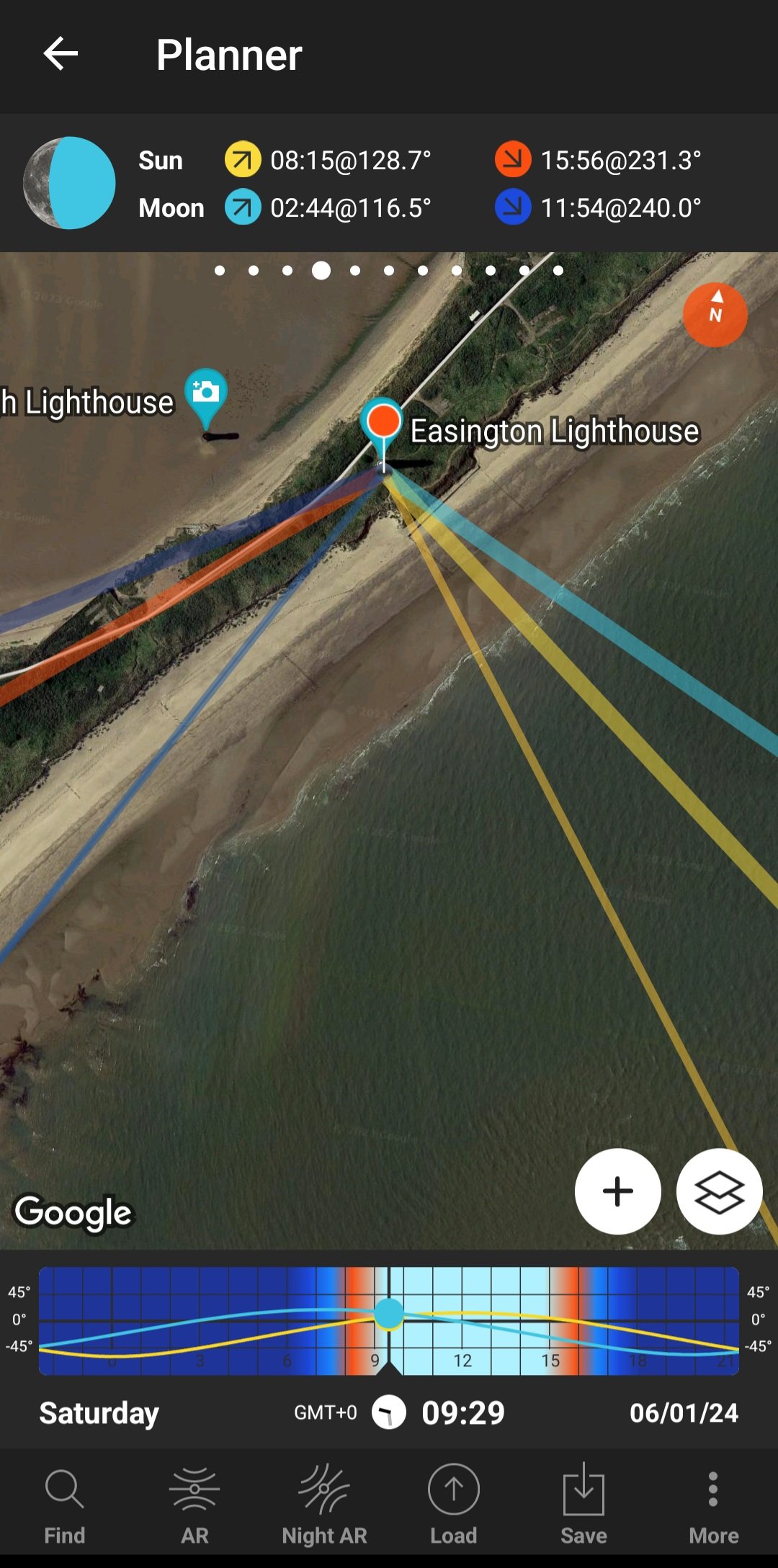
Photopills is a must-have app for photographers seeking to elevate their craft through precise planning and creative visualization. Offering a comprehensive set of tools, this app is a powerhouse for those who want to master the art of capturing stunning moments. It provides detailed information on the position of the sun, moon, and stars at any given location and time. This feature is invaluable for planning shots with perfect lighting conditions. Photopills is a powerhouse for photographers who want to go beyond capturing images and delve into the art and science of photography. With its precise planning tools and creative features, it's an essential companion for those seeking to turn their visions into breath taking photographs. While there may be a learning curve, the app's potential for unleashing creativity makes it a worthwhile investment for serious photographers. Downloading this app will cost you about £10, but for planning sunrise, sunset and moonrise photography shoots it’s a must.
British Hills
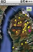
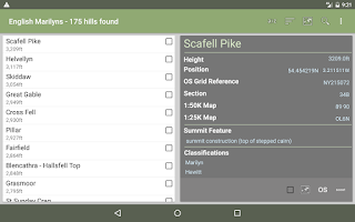
The British Hills app is a digital companion designed for adventurers and nature enthusiasts looking to explore the diverse landscapes and hills of the United Kingdom. With the promise of providing information and insights into the UK's natural wonders. A great free app for anyone that is into bagging hills. Lists of all the Munros, Murdos, Marilyns, Corbetts, Donalds, Grahams, Hewitts, Nuttalls, and Wainwrights with trackable lists and grid references. Tick them off as you do them, and a handy little map feature to see other nearby summits.
As technology continues to advance, outdoor apps have become indispensable tools for adventurers, nature enthusiasts, and anyone looking to make the most of their time in the great outdoors. Whether you're navigating trails, observing the night sky, or identifying plant or bird species, these apps add a new dimension to outdoor experiences, making them more enjoyable, educational, and memorable. Embrace the power of technology and let these outdoor apps be your companions on your next adventure. There are of course hundreds of other apps, each app collection will be different depending on the persons hobbies and lifestyle. The above apps are just a snapshot of dozens that I have and use regularly, and I would love to hear of any key apps that are missing from this list. As always, thanks for reading, and Happy Exploring.